Crossing the Credit: A New Connection for the Credit Valley Trail
A New Bridge Brings the Vision of a Connected Credit Valley Trail One Step Closer
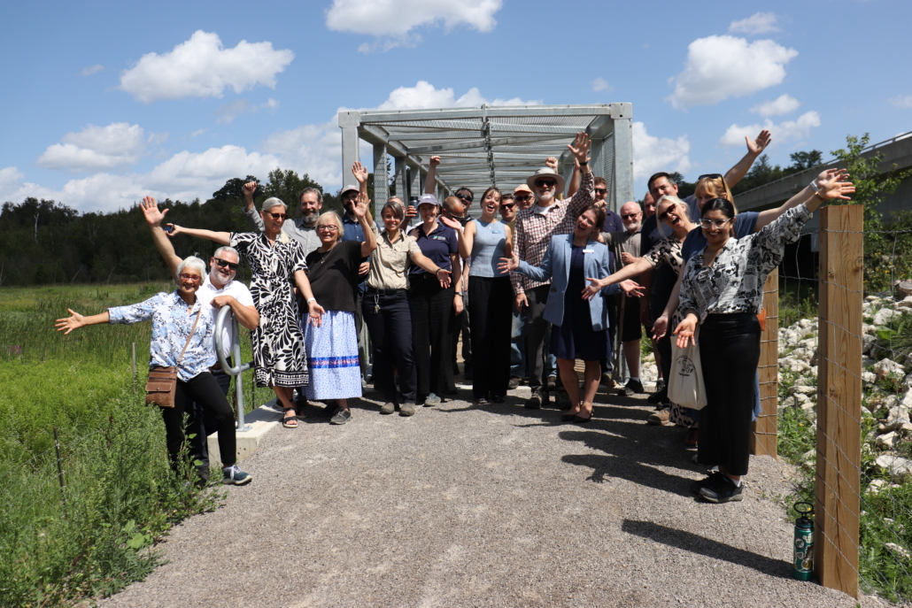
There are moments when a trail takes a visible step forward. For the Credit Valley Trail (CVT), the opening of a new pedestrian bridge at Credit Valley Conservation’s Upper Credit Conservation Area is one of those moments.
Spanning 40 metres across the Credit River, the new bridge creates an important connection along the CVT and brings the vision of a 100-kilometre trail through the Credit River Valley one step closer to reality.
But this bridge is about more than crossing from one side of the river to the other. It is about connecting people, places and communities — and creating new opportunities to experience the landscapes that make the Credit River Valley so special.
Connecting the Trail
The CVT is envisioned as a continuous 100-kilometre pathway stretching from the headwaters of the Credit River in Dufferin County to the Lake Ontario shoreline in Mississauga. Today, 43 kilometres of the trail is connected. Every new connection helps bring that vision to life.
The new bridge provides a key crossing of the Credit River along the planned route of the CVT, helping connect to CVC’s Island Lake Conservation Area (the CVT northern trailhead) and the communities of Caledon. It also improves connectivity within the Upper Credit Conservation Area, linking trails on either side of the river.
Looking ahead, this connection will also help support future opportunities to connect with the planned Caledon Rail Trail along the former Orangeville Brampton Railway corridor.
Piece by piece, these connections are helping transform the CVT from a vision on a map into a trail people can experience.
A Bridge Through the Landscape
For those who cross it, the bridge offers more than a way across the river.
Upper Credit Conservation Area is part of the upper Credit River watershed, where wetlands, forests and river valley landscapes come together. From the bridge, visitors can take in expansive views across a provincially significant wetland and the surrounding landscape.
These are the kinds of places that remind us why connecting people to the Credit River Valley matters.
The CVT is being designed not simply as a route from one destination to another, but as an opportunity to experience the watershed — to walk, explore, pause and discover the natural and cultural stories of the Credit River Valley along the way.
Visitors can access the new bridge from Orangeville’s Cedarstone Park, providing an opportunity to experience this new connection and explore Upper Credit Conservation Area on foot.
Many Partners, One Connection
A project like this doesn’t happen alone.
The new bridge was made possible through collaboration among conservation, government and community partners. Funding from the Government of Canada and the Government of Ontario through the Investing in Canada Infrastructure Program supported the broader trail infrastructure project, while Dufferin County played an important role in enabling the trail connection through a new easement within the County Road 109 right-of-way.
The bridge was constructed between July and November 2025, with final restoration and trail work completed in spring 2026. It is another example of what can happen when partners come together around a shared vision for the Credit River Valley. From municipalities and Indigenous partners to community organizations, funders, landowners and volunteers, the Credit Valley Trail continues to be shaped by many hands and many voices.
Building the 100-Kilometre Vision
Since trail-building efforts began, the CVT has continued to grow one connection at a time.
Today, 43 kilometres of the trail have been secured, with 17 park connections helping link the CVT to existing parks and conservation areas. More than 110 community, municipal and Indigenous partners have contributed to the shared vision, with fundraising continuing to support land securement and trail development. Indigenous placekeeping is also an important part of the trail’s future, with seven Doodem spaces planned along the route. The first, the Ajijak (Crane) Gathering Space, is complete at CVC’s Island Lake Conservation Area, while the Giigoonh (Fish) Doodem at the Charles Sauriol Conservation Reserve is currently in design. Learn more about the Credit Valley Trail and its progress.
The new pedestrian bridge is an important milestone — but it is also a beginning. As more pieces of the trail come together, the vision becomes easier to see: a connected pathway through the Credit River Valley that brings people closer to nature, celebrates Indigenous heritage and values, connects communities and creates new opportunities to explore the watershed. One bridge may span the river, but its connections reach much farther. The Credit Valley Trail is being built one connection at a time — and this is an important one.
By Natalie Faught, Conservation Lands Planner, Credit Valley Conservation
